Monday, July 27, 2015

Touring the Backroads

Back during the monsoon season in May, Cousin Glynda alerted me to a historical tour that was going to take place via bus in parts of Bastrop, Williamson and Lee Counties.  She knew that my maternal grandparents had lived in that area during my childhood and, given my family history bent, thought I might be interested in tagging along.  It turned out that the tour was to be based on a book by Charlene Hanson Jordan, a book I had owned for quite some time, entitled "Stuck in the Mud at Post Oak Island".  Mrs. Jordan would be our tour host.  While my ancestors were not involved in the settlement of this particular area, I am interested in all things related to Bastrop County history and it involved an area that I was somewhat familiar with, so I signed on. 

Alas, the week preceding the scheduled tour, the area received non-stop rain and it was decided that it would not be particularly wise to aim a large tour bus down potentially washed out and/or muddied out country roadways, so the tour was rescheduled to July when it could be almost 100% sure that dry conditions would prevail.

I had almost forgotten about the whole thing during the course of the Colorado trip and the early July work crush, but when the fog cleared and I was finally getting a bit of free time to take care of personal business, I glanced down the calendar a few weeks and realized that I had a date to tour some backroads.  Yesterday I headed a bit north of Elgin to finally take advantage of the opportunity to see some parts of Bastrop County I had no idea existed.

The book that inspired the tour.
Post Oak Island refers not to a portion of the County that is surrounded by water, but rather an area part prairie, part sandy land that at one time was home to an isolated grove of post oak trees.   A good percentage of the settlers drawn to the area had Scandinavian roots and many of the community names reflect this.

We began our tour at the Yegua Creek Evangelical Church, which sits in the area once known as Type.  This is not the original location of the Church.  It came later to build next to the Type Cemetery and it now oversees the maintenance of the historic cemetery where many of the original settlers are buried.  The church sits out in the country amid fields and old homesteads and roads that twist and turn until you can get so turned around you have no idea where you are.  (I can attest to this because I looked up the route to take out to the church, but decided to let the GPS take me home.  I didn't pay much attention to the fact that I wasn't retracing my route in until I had been directed this way and that and the next thing I knew I was surrounded by brown corn stalks on every side with no idea which way was out.  Thankfully the GPS may have been taking a circuitous route back to the highway, but it did get me there.  Eventually.)

Yegua Creek Evangelical Free Church

Type Cemetery, adjacent to the church
Cousin Glynda and her son Daniel (who was our driver for the day) work for the travel company that was providing the bus, so I had a bit of an inside track on this outing.  Otherwise I might never have heard about it.  It turned out to have been publicized more in the Elgin area (I guess I'm not as well plugged in over there as I thought) and I was pleasantly surprised that a few folks with whom I have other historical connections turned up to share the afternoon.  We departed on our 5 hour tour in air-conditioned comfort, with plush seating and on board restroom facilities, during the hottest part of the afternoon.  But inside the heat was not an issue and outside it wasn't raining, which was a big plus over the original plans.

Our chariot, driven by Cousin Daniel Melton
The route we took was a series of overlapping circles out along narrow, but mostly paved, roadways through the area where Bastrop, Williamson and Lee Counties join.  We headed first to Pleasant Grove, which is a very familiar area to me since I have kinfolks living out that way and since I've visited the cemetery there many times.  The biggest surprise to me on this portion of the trip was how quickly I realized where I was, even though I was approaching it from an entirely new direction.  To get to the house where my Grandparents Hodge lived when I was young, we would drive out Pleasant Grove Road until it ended and then take what was then a series of gravel roads out to the middle of nowhere and I would quickly get a bit turned around and have no idea where I was or how to get to the farm.  Later when I began to drive, I finally learned my way out there but was never really comfortable with any detour off that learned route.

But, as we approached the Pleasant Grove Road from the opposite direction I know, I was suddenly aware of exactly how I would proceed to go out to the old farm place.  It's taken me most of my life, but I guess I finally know my way around out there.

After stopping briefly at the cemetery for a short talk on the history of Pleasant Grove by one of my mother's old schoolmates, we were back on the road and beginning to circle back to our point of beginning.  We saw points where old school houses and old churches and old stores once sat and where once thriving farms have been replaced by exotic game ranches.  (I think we saw at least three exotic game ranches.)

One of our stops was to see a unique house that a young couple has built into the side of a hill.  We were allowed to go inside and take a look, and all of us were impressed with how nice and roomy a house it was, although from the outside you would never guess how deep into the hill it extends.  Solar panels are mounted on the hill above the house and we were all interested in the little unit you can see in the picture below just above and behind the gentlemen in the driveway.  That little outhouse looking building provides the means to heat the house.  I didn't get all the technical details, but I did hear that part of the source involved a wood burning option.  I had two thoughts upon leaving the interior - (1) that it would be an ideal place to sit out a tornado threat and (2) I would go crazy in a house that has no windows except for a few on the front side.

Entrance to a house built into the side of Catfish Hill.
A lot of the places we visited were now empty fields, with the occasional old cistern remaining behind to indicate where the school or other building once sat, but a few buildings remain.  We saw an old settler's cabin that had been moved from a few miles away to sit beside the Lawrence Chapel and Cemetery.

A dog-trot cabin that was originally the home of Adam and Sarah (Miller) Lawrence.

Lawrence Chapel, with an unusual curved front
We meandered around to Beaukiss, which I've heard of all my life and don't think I've ever actually seen until now.  We stopped briefly at an old Masonic Lodge, home of the Post Oak Island Lodge #181, which is still active.

Post Oak Island Masonic Lodge
After leaving Beaukiss, we made our way to Lawhon Springs, another one of those places I've heard of all my life and never visited.  Historian Audrey Rother took over the microphone there to give us a bit of history on that area where her family lived.  We saw the old school house and the location of the springs which gave the place its name.  From there we drove to Down Home Ranch where most of our party got out for a presentation by the founder.  Glynda, Daniel and I have been to Down Home Ranch many times, so we opted to stay on board the bus and have a nice catch-up visit.  I heard some pretty good tales involving road trips that Glynda's family took years ago with her mother and aunt (my great-aunts Ruby and Ora).  All I can say is that any activity involving those two ladies (and their sister, my Grandmother Ivy) generally included some hilarious stunts.  This time I heard about the time they all went on a paddleboat ride on the Mississippi River and Glynda having warned all her youngsters to stay out of the dirty river when the boat docked, only to look out and see Aunt Ora paddling around in the water.  Those old ladies were always a hoot and you never knew what to expect from them, except that you would sure have a good story to tell afterwards.

Back on the road, we ended the tour in Siloam where the Yegua Creek Farms is located.  This operation is a pecan orchard and commercial kitchen and they were waiting for us with Bar-B-Q and fixings and we all were more than ready to take on some vittles at that stage.  Again, I had no idea this place existed, but if you are wandering around the backroads around Elgin, this would be a good stop to make.  I just wish I had had the opportunity to pry the cucumber salad recipe out of the folks.  I don't like cucumber salads, but I loved that one.

After our meal, we headed back to the church, tired but happy with our afternoon's activities.  I grabbed the opportunity to purchase a couple of books by a local author, then headed home under the questionable directions of the GPS lady.  I missed a couple of photo ops that I had spotted on the way out to the church that morning, so I may have to go back at some point, but at least I got the opportunity to grab a few photos at a tiny crossroads next to fields of mature milo (which I always called maize, but I learned during the tour is really milo - live and learn).  I love seeing these fields of red in the early and late sun.  Pictures really do not do it justice.

Milo

Looking out over a field of milo.
I really didn't think there was a whole lot I was going to learn when I headed out yesterday morning.  After all I've lived in Bastrop County for 40 plus years, was born in Elgin and carried all around that area by my grandparents and parents when I was little, and have been a family historian studying the various spots in the area where family lived for decades - but I have to say it was time well spent and I will probably have to retrace the tour route on my own when the weather gets a bit cooler.

The other memory I will keep of this day is the experience of traveling those narrow little roads in such a huge bus.  Traffic on those back roads is fairly sparse, but it was comical to look down the road and see a pickup round the bend headed toward us and see them pause - consider - and cautiously approach us, hugging the far side of the road as close to the edge as possible.  I was thoroughly impressed by my cousin's ability to maneuver that bus, backing down one lane drives when there was no turnaround and swinging out so wide to make a turn over a culvert that you would be sure we were going to land in the ditch, only to swing into the turn with inches to spare.

Being a historian may sound dull, but dull is in the eye of the beholder.  I had a heckuva good time yesterday.

LSW

Tuesday, July 21, 2015

Making the Connections

Back in February when we started making reservations, I ran into a bit of a problem.  The root of that problem was that I don't fly very often and I haven't learned the tricks of getting where I want to be if the airlines don't happen to have the right combination available as a choice.  I was wanting to fly in and out of small town airports and the round trip combinations offered just didn't work out.  I could fly into Durango fairly easily, but flying out of Gunnison was a problem.  All the flight connections arrived in Austin at midnight or later and there were major layovers in Denver.  I just did not want to have to deal with making my way through the airport that late at night.  So I decided I would just have to pass on the trip.

But Karen is much more experienced in figuring out ways around scheduling problems with the airlines and before I knew it, she had it worked out so I could get back to Austin a little before 10 pm.  Still not ideal, but at least I would still be more or less functional at that hour and less likely to have hysterics if I ran into snags retrieving my baggage or finding the shuttle to my car.

It wasn't until I was getting all my boarding passes pulled together before leaving the house that I began to wonder whether I was going to be able to handle the last day of travel after all.  In order to catch my plane in Denver, I had to get up at the crack of dawn and catch a bus in Gunnison at 6:20 a.m. that would take me to another bus that would take me to the bus station in Denver.  Then I had to figure out from there whether I was going to take another bus to the airport (about an hour ride) or grab a cab at an astronomical price.  Theoretically I would have about 4 hours to figure that last part out if I didn't mess anything up along the way.

I'm one of those compulsive people who maps out everything in detail before a trip, so it was that last part that had me agitated the night before.

Bright and early we were up and loading the car and driving into town to a gas station that serves as the Black Hills Stage Line bus stop.  I wasn't the only one catching the bus, but I was definitely the oldest one catching the bus.  All the other passengers looked like, and probably were, college students.  I had been expecting a Greyhound style bus, but instead it was a shuttle bus and wasn't big on comfort.  At least there were few enough passengers that we could spread out and have plenty of arm and leg room.

I was fairly relaxed at this point - until we started running into the road construction.  This is not an unusual phenomenon in summertime Colorado and you get used to sitting and waiting 15 to 30 minutes for your lane's turn to move.  It's one thing to run into a construction wait when you are out sight-seeing, but it's another when you are supposed to be catching a connecting bus in an hour.  About the time we hit the second construction stop, I was beginning to speculate about whether there were any car rental places in Salida.  Even though our driver was hauling it (and that in itself was worrisome as we were going up and over Monarch Pass, a drive that gives me the willies when I'm behind the wheel), we were running about 20 minutes behind schedule when we finally rolled into the bus stop.

Thankfully, we saw our connecting bus (this time it was a big Greyhound) waiting for us to arrive.  We were slinging baggage out of one bus into the other at top speed and back on the road in about 10 minutes.  We were an hour out of Gunnison and I was pooped already.  There were only about a dozen passengers on board, so we all spread out again.  Our original group of college kids plus one old lady were joined by a young mother and sleeping child, a middle-aged lady who almost got left behind at the second stop when she got off to use the bathroom, a guy who was either high or not quite all there, and a young man who kept up a non-stop shouting conversation with the driver in Spanish (they had to shout thanks to the motor noise and the driver sitting behind a plexiglass panel).

We lost the spacey guy at the first stop, thank goodness, and after that I stopped feeling like I had to keep an eye on my belongings.  And after the minor excitement of almost losing a passenger at the second stop, things settled down.  Despite my intention to watch the last of the mountain scenery slip past, the restless night and the morning nerves were beginning to catch up with me.  The conversation in the front of the bus continued unabated and developed into white noise that, along with the rocking motion of the bus, allowed me to doze off for awhile.  By the time I and the little boy across from me woke up, we were beginning to approach the outermost suburbs of Denver.

I guess all big city bus stations are probably the same.  I had decided that I had enough time to take another bus to the airport and headed toward the ticket desk - only to discover a long waiting line of folks, many with upset kids and piles of baggage.  It did not seem to be moving very fast.  I glanced toward the opposite site of the room and the main doors and saw a line of waiting taxis.  I decided whatever the cost, it was worth bypassing the aggravation of that daunting ticket line and getting myself to the airport in the fastest way available.

So I made a beeline out the door and was quickly on my way.  It turned out the cost wasn't nearly what the online searches had led me to believe, so I congratulated myself on making a good decision.  It wasn't long before I wondered just how smart I really was, because my taxi driver seemed to be trying to beat his best time from the bus station to the airport.  I think he would be right at home driving a cab in New York City.  He was weaving in and out of traffic at 70 mph and slamming on brakes and then flooring it again.  I told myself that since it had seemed on the entire trip that my guardian angel was working over-time to ensure that everything worked out along the way, either I was going to live to see the airport or there was nothing I could do about it anyway.  So I sat back, stopped backseat driving and found myself actually enjoying the wild ride.  We skidded into the drive next to the American terminal and then ensued 15 minutes of the driver trying to deal with a balky credit card reader.  But I was safely at the airport much earlier than I had expected to be and all was well with the world as far as I was concerned.

I was pretty punchy, though, so for the first time ever I was the idiot traveller who had to go through the screening gate 3 times because I kept forgetting about the stuff in my pockets.  One advantage of having reached the age I am is that they just rolled their eyes and waited for the dingbat to get it together instead of yelling at me.

This seems like a good place to insert a few comments about the people I observed while waiting around in airports on this trip.

(1) If you are in a relationship and traveling with your significant other, and especially if you are a woman (as much as I hate to be that specific), for God's sake it is not necessary to talk non-stop to your partner just to fill the silence.  I heard more women uttering more inanities to poor men who were sitting alongside with their eyes glazed over like they were being systematically tortured.  I would attribute it to nerves about flying since I tend to chatter when I'm nervous - except I see the same thing happen all over the place in smaller doses.  It just seems to be amplified in airports where so many people are stuck waiting for an hour or more with not much to do.  After spending time in an airport, I begin to wonder how anybody manages to stay in a relationship if they don't know how to be quiet together.

(2) If you are traveling alone, striking up a conversation with another traveler is fine.  Good even.  Helps pass the time.  But don't go on and on and on in a monologue about all the places you've been and how this airport stacks up against all the other airports you have ever been in.   I got ensnared in such a conversation with another woman who was headed to Dallas and who proceeded to tell me that I should go try and get on the earlier flight with her.  Well, aside from the fact that all the flights to Dallas were being announced as full or overbooked, I sure as shootin' wasn't going to end up flying with that chatterbox, so I suddenly needed to use the restroom and took myself off down the terminal aways until I found a quiet seat next to a plug where I could charge my phone and sat there until I was sure her plane was off the ground.

(3) This is just a personal wish.  If you have an infant, it would probably be best not to take any trips by air for at least - oh say 5 years or so after birth.  The last leg of the trip from Dallas to Austin included a non-stop serenade by two infants who really weren't enjoying the experience.  This was about 16 hours from the time I had rolled out of bed that morning and my nerves were exceedingly fragile at that stage. I almost joined in with the concert.

(4) Now that I think about it, perhaps you shouldn't fly with your children until they are old enough to drink.  Although I would make a few exceptions.  On the flight to Dallas I was waaaaay in the back of the plane and sitting beside a young father and his perfectly well-behaved son of about 10 years old.  I think the boy was nervous about flying, because as soon as we started rolling away from the gate, he shifted to put his head in his dad's lap and closed his eyes.  The two of them fell asleep before we had finished climbing and presented a sweet little picture that warmed the heart.  But then there was the twenty-something sitting behind me with two younger boys who I am assuming were siblings since they were paying absolutely no attention to his pleas to settle down.  I think they must have been having a friendly tussle about something, judging by the bumps against the back of my seat and the dull roar of hilarity that occasionally erupted to disruptive levels.  Added to that distraction, the two flight attendants and a pilot, who was getting a lift and had to stand up the entire way because the flight was sold out, were huddled in the back galley having their own little party.  Let's just say that neither of the flights home was particularly restful.  Thank heavens for knitting as a calming activity under stress.

(5) Which brings me to another personal pet peeve.  If you see somebody working on some needlework involving yarn, here's a handy guide to keep you from getting snapped at.  If the person is working with more than one needle, they are knitting.  If they are using one needle and it has a hook at the end, they are crocheting.  I have never heard anybody but another knitter or crocheter get it right.  I'm always asked what I am crocheting.  I've seen numerous folks crocheting being asked what they are knitting.  It seems to be the rule to get it backward.  It is fine to ask what we are making.  It is fine to admire the work in progress.  It is fine to tell me that your grandmother performed magnificent feats of either knitting or crochet.  But, if I had a dollar for every person who has said "I just couldn't do that" or "I just don't have the time to do that", I could retire now.  It's not that hard, it just takes practice like anything else.  And if you are sitting in an airport waiting for a plane, you have the time.  Better to say "I would never in a million years want to sit and play with yarn".  Fine.  I just happen to prefer doing something productive to sitting around playing Candy Crush on my phone.  (No offense intended.  I've wasted many an hour playing computer games in my past.  I just got tired of wasting time and decided to do something with it instead.)

We finally pulled into the gate in Austin about 9 p.m.  I was never so happy to get somewhere in my life.  The airport at that time of night is a whole different experience from the airport in the morning.  It seemed to be in the same state of exhaustion as we were.  We all trudged our way to the baggage carousel like zombies crawling out of our crypts.  Finally I retrieved my bag, found the shuttle to the parking lot, crawled into my car and started home.  Other than almost driving out in front of the shuttle as it headed back to the airport, the trip home was uneventful and I was welcomed home by the furry kids with many barks and baleful glares.   Getting home is always the best part of a trip, no matter how much fun you have had.

To close out Cindy's Marvelous Adventure 2015, I wanted to include a few pictures of the souvenirs I brought home.   Bringing everything home turned out to be a bit of a challenge, since I rashly purchased a basket that I didn't need but that I thought would be nice for a small knitting caddy.  I ended up opting to check my biggest bag and acquiring a tote bag in Crested Butte (a bag that I absolutely adore) for my extra carry-on.  I put the basket in the bottom of the tote and packed everything else that wasn't a T-shirt inside the basket.  Mostly that was a nice collection of miniatures to add to my Southwestern art gallery dollhouse.  On top of the basket full of minis I added the yarn I had purchased for extra padding.  It was a perfect solution.

So the final count for souvenirs was 6 T-shirts, 4 books and assorted pamphlets, one pin, one patch, one dog collar (which turned out to be too small, drat it), one leather purse, one tote bag, 3 skeins of luscious yarn, 1 basket and the following additions to various dollhouses.

Moccasin earrings with turquoise accents.
I just remove the earring fittings and voila!
Miniature moccasins for sale in the dollhouse store.

Tohono O'Odham (Papago) Horsehair Basket with Turtle Design
The smaller basket is from an earlier trip, but by the same artist.


Handwoven basket by Sue Fedenia and a tiny petroglyph magnet.

Tiny pottery pieces picked up here and there on the trip.

Tiny wolf sculpture made of fossil mammoth ivory.

Tiny reproductions of a local artist's work on printable magnet backing.
Unfortunately, as soon as I got home, I was hit with an onslaught of work, so nothing has been done about adding these to their new homes yet.  Hopefully that will happen soon and I can share photos of the new and improved Turquoise Moon Art Gallery.  I started that dollhouse to showcase all the miniature pottery I had picked up over the years on our travels to Colorado.  David has brought back quite a few wonderful additions over the intervening years, but there is nothing like going out there personally and seeking out more tiny treasures to add to the collection.  It's nice that I can bring all my tiny treasures home inside a small basket.  But on the other hand, those tiny little treasures can get pretty pricey.  I'm already beginning to figure out the budget for the England trip that is coming up in another year or so.  I did a good bit of damage to my bank account this trip thanks to my philosophy of "who knows when I'll be back".  I can just imagine the wild justifications I'll be able to make when I'm across the pond.

In closing, here may be the most scenic photo I took the whole trip.


. 
The descent into Austin.
LSW

Friday, July 17, 2015

The Scenic Routes

By request, I am inserting this post to give more specifics about the various routes we took on our scenic sight-seeing.   If you happen to find yourself between Durango and Crested Butte, I can recommend them all, with the warning that a good high clearance vehicle with 4-wheel drive is pretty much required for the really spectacular views.  Also, some of the roads we traveled are only open from June thru September, so if you visit earlier or later, be sure to inquire locally before heading up to the higher passes.

In Durango, be sure to ride the Durango & Silverton Narrow Gauge Railroad for some great views from the vantage point of a viewing window in a rail car perched on the edge of the mountain.  You don't have to worry about mountain driving - you can just sit back and enjoy the ride.  If you ride the open gondola, be prepared for your hair and clothes to be covered in a fine layer of coal dust when you reach the end of your trip.  (Reservations recommended to get the seats you want.)

Riding along the Animas River, D&SNG RR
The first car drive we took with jaw-dropping scenic views was Highway 550 between Durango and Ouray, also known as The Million Dollar Highway.  It is named for the cost of building the highway, but could just as well be named for the million dollar views along the way.  This is a beautifully maintained highway, drivable with any vehicle.

Approaching Silverton on Highway 550 
From our base in Ouray we took two scenic tours.  The first was out Camp Bird Road (also known as 36 - I'm assuming that is a state or county road number).  This is definitely a trip to be made in a 4-wheel drive vehicle.  There is a fork at one point and we took the option for Yankee Boy Basin and by the time you get there, your back teeth may be jarred loose.

Headed down from Yankee Boy Basin
Our second scenic tour involved driving to Telluride and back.  From Ouray we went north on Highway 550, turning west on 62 at Ridgway.  About 15 miles or so out of Ridgway, you are treated to wonderful views of the Dallas Divide.  The road runs into 145 at Placerville and we turned onto 145 and stayed on it to Telluride.  This drive is on well maintained paved roads and can be made with any vehicle.

We did not return by the paved road, however.  We returned by Last Dollar Road and while 4-wheel drive isn't mandatory, a high clearance vehicle is and 4-wheel drive is recommended.  From Telluride, we took 145 a short way back, turning on the road that leads to the airport (look for the sign).  This road will branch shortly down the way from the turnoff, with the left option leading to the airport and the right option turning into Last Dollar Road (also known as T60).  This drive winds and winds, goes over shallow, rocky creeks and shallow rock slides and at some point you will begin to wonder if you took the wrong road and you are never going to see civilization again.  There are wonderful views of mountains, valleys and aspen groves and it is well worth the bouncy ride.  You will be traveling through private property, so be careful of getting out and wandering too far off the road.  

Eventually you will reach the end of the twisty little dirt road and you will find yourselves approaching Highway 62, just west of the lookout over Dallas Divide.  Turn east and you will soon be back in Ridgway.

Little side note here.  Large portions of the original True Grit motion picture were filmed in this area.  There is a little cafe/bar named True Grit on the square in Ridgway.  We did not eat there this time, but I've eaten there many times in the past.  Not a bad place to stop for a drink after traveling on Last Dollar Road.  It used to be full of atmosphere and I imagine it still is.

Looking back as we came to the end of Last Dollar Road
Leaving Ouray, we headed toward Gunnison by way of Highway 550 to Montrose.  At Montrose we turned east on US 50 (there is now a loop around the business district, or you can turn east on Main Street and cut through town until you hit US 50).  About 10 miles or so from Montrose is the road leading to Black Canyon of the Gunnison National Park (watch for the sign).  There is an entrance fee, but make sure you don't miss Black Canyon.  While in the Park, just follow the park roads and you will see the turnouts at all the places where you can hike out to the canyon's edge and see the awesome canyon views.  Do yourself a favor and don't skip any of the stops because each one of them has a unique perspective of the canyon.

The Visitor's Center at Black Canyon of the Gunnison National Park
After leaving the Park, we stayed on US 50 heading east to Gunnison.  About half way there you come to Blue Mesa Reservoir, which is a beautiful lake and a lot of fisherman spend their entire vacation there.  

There are many, many places to stay in the Gunnison area, but I highly recommend going on to Almont and staying at Three Rivers Resort.  It was a delightful 3 days we spent there.  Turn north on Highway 135, which is also Gunnison's main street.  Almont is about halfway between Gunnison and Crested Butte and three rivers come together there in a rush of white water.  If you need groceries, stop in Gunnison before you head out because there are just the basics available in Almont.

The first full day we were there we made the scenic rounds in the Crested Butte area.  From Almont, continue on Highway 135 north to Crested Butte.  The first scenic drive we took was to Lake Irwin and you will take 12 (also known as the road to Kebler Pass) to reach Lake Irwin.  Do not be fooled by maps that make it look like you can take the road all the way over Kebler Pass to Aspen.  You can't.  It is 4-wheel drive for a good long way but eventually it becomes impassable.  This road is closed during winter.

Keep a lookout for signs indicating a turnoff to Lake Irwin and/or the Lake Irwin campgrounds. It's about 12 miles after you have left Crested Butte behind.  The road up to the Lake is rough, so I wouldn't recommend trying to go by car.  Once you have turned off the main road, it is another few miles up to the lake.  There are picnic tables and composting toilets available and the freshest air you will ever breathe.  A not-too-strenuous hike will take you down to a nice little waterfall.  Folks are fishing and boating and sunning on rocks and camping a bit further up the road from the lake.  It's a gorgeous place and well worth the trip.

Lake Irwin
The second half of our day of scenic driving in the Crested Butte area was further north of town.  Continuing on 135 past the turn into the historic district, proceed north veering onto 317 to Mount Crested Butte (the ski resort) and keep on driving.  You soon begin climbing gently and the historic town of Gothic will come into view about 8-10 miles past Mount Crested Butte.  There is a little store in Gothic with some souvenirs and information, but the whole area is part of the Rocky Mountain Biological Laboratory and you are not permitted to roam around.

Keep driving past Gothic and you will soon be back in areas where you can explore a little.  There are many little government campgrounds spotted along the road.  They are all primitive campgrounds, so don't expect much in the way of amenities.  If you keep on going, the road will take you to Schofield Pass and I think it pretty much ends there.  Once you are well past Gothic, the road is in questionable shape, so again 4-wheel drive is recommended,  You'll find yourself surrounded with beautiful mountain vistas and on the way back toward Mount Crested Butte, watch for the little meandering stream in the valley.
David checking out the stream in a valley just north of Gothic.
Our last day we headed east out of Almont on the Taylor Canyon Road (742).  This road is dotted with little government campgrounds and also with the odd herd of cows wandering about.  About 15 miles from Almont you will come to Taylor Lake and the little settlement called Taylor Park.  Continuing left on 742 would take you to Cottonwood Pass.  We chose to turn on 765 toward Tin Cup and ultimately Cumberland Pass, as described in my previous post.  While the road to Taylor Park is paved and easily passable by car, once you switch to 765 you are headed toward rougher road.

When we descended the mountain and arrived in Pitkin, we turned onto 76, which led us back to US 50 about 15 miles or so east of Gunnison.  There are a lot of scenic areas that you can detour to off 765, but do your research before you go.  On my first trip we made the trip up to see the Alpine Tunnel and I'm still wondering why we thought we needed to do that.  We made a slow drive up a mountain for something like 20 miles and saw a caved in tunnel with a historic information sign and then we had a slow 20 mile trip back down to the main road.  Interesting?  A bit.  Scenic?  Not so much.

Somewhere between Tin Cup and Pitkin
That was the last of our backroad rambles.   We've made many, many other trips on the backroads of Colorado in these areas, but these are the favored places that we wanted to return to.  They are tried and true and I hope someday some of you get to see them as well.

LSW

Thursday, July 16, 2015

On Top of the World

After leaving Cold Spring Campground, we kept climbing up the canyon toward Taylor Park.  Taylor Park is a fishing hub that sits at a crossroads with a gorgeous lake and mountain view.  Just before we reached the little settlement, we stopped for photos at our usual spot, a scenic overlook of Taylor Lake.
Picture perfect day

David and Karen
At the crossroads you can turn left and take the road to Cottonwood Pass, which ends up in Buena Vista and a good highway that runs back to Salida, about 50 miles from Gunnison.  We always turn right and head for our number one favorite mountain road that goes to Tin Cup then climbs its way over Cumberland Pass and then heads down to Pitkin and Ohio City before coming out on the highway about 15 miles from Gunnison.

Tin Cup is a small historic settlement a few miles from Taylor Park.  There's plenty of beautiful scenic drives that take off toward lakes and historic sites in various directions, but we usually settle for just looking at the town as we pass through.  This time we ventured into a bit of new territory.  For some reason we had never paid any attention to the sign that pointed off toward the Tin Cup Cemetery, but it caught our interest and since the genealogist in me hates to take any trip where I don't visit an old cemetery along the way, we veered off our course to check it out.

One thing that has changed tremendously since my last visit to Colorado is the proliferation of ATVs running around the backroads.  We had expected to be the only visitors to the little rural burial ground, but it was a hopping tourist stop for the ATV crowd.  The little parking lot was filled to capacity and people were wandering around all over the place.  Thankfully all of them were showing proper respect and real interest in reading the old tombstones.

Every sign we saw on the way out had the same misspelling of "cemetary".

There were all kinds of grave borders, from iron fencing to log rails, and
all manner of tombstones, from modern granite to rough wooden planks.


I would love to have had time to completely photo document the tombstones, but it wasn't feasible.  The cemetery sprawled over a wide area, some parts of it separated by water and embankments that took a bit of effort to climb.

It wasn't far past Tin Cup that the road began a steep climb and we were on our way to Cumberland Pass.  Slowly.  The road gets a bit rough in places and there was still snow alongside the uppermost switchbacks.  Along the way up we spotted a little vacation home that we might actually be able to afford.  (But I wouldn't bet on it - property prices are as steep as their location in this part of the world.)

Air-conditioned, one room cabin, spectacular scenery,
running water, solar heating, ecowise construction.
The weather was getting a little dicey by the time we reached the summit, with distant lightning and thunder getting less distant by the minute.  We stopped for some pictures, but decided that we should probably start down the mountain before any rain came along to make the drive any more difficult.


Standing at the summit.

View from the top
There is a cluster of old mine and cabin ruins that we always visit on the way down the mountain and by the time we reached that level, the threatening weather was beginning to get a bit closer and a lot louder, so we didn't hang around too long.  But this is the first old mine ruin I ever got to get close to, so it is mandatory to visit on every trip.  There is a bubbling creek that runs out of the ruins and on my first visit it was full of little tiny gold flecks that I decided just had to be gold dust.  (Probably not, but it was my little fantasy and I scooped up a cup full of that sand flecked with gold and it's still with me somewhere in one of the closets.)  The structures have decayed a noticeable bit since I last visited, but there is still a picturesque quality to the area and the next time I'm in Colorado, I'll be back for another look.

The old mine.

One of the old buildings at the foot of the mine.

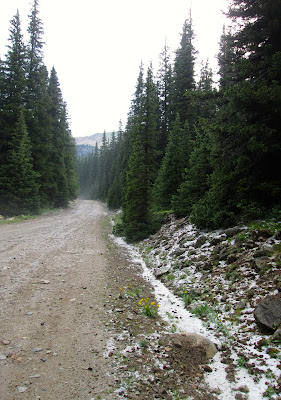
A little further down the mountain we finally ran into the weather and discovered fresh sleet all along the sides of the road.

Christmas trees and snow in July.

The road back up the mountain.
It was only a short drive on to Pitkin, where we stopped for coffee and snacks in a little cafe with a hyper-cheerful waitress, then it was back on the road to Gunnison.

The remainder of the afternoon was spent reacquainting ourselves with the shopping in Gunnison and driving through the campus of Western State College.  Gunnison remains one of my favorite Colorado towns because it is a real town with real people.  There is a thriving fishing business that Gunnison caters to, but mostly it is just a county seat with a small college and real people going about their real lives and not all that interested in sight-seeing tourists.  (They're happy to see you and your money, don't get me wrong, but there really isn't that much "tourist" fare to be found in the shops.  For that you need to keep driving up to Crested Butte.)

Our last night in Gunnison was marked by a nice meal at the Old Miner's restaurant and another spell of sitting out on the deck above the Taylor River.  I was edgy about the next day and all the different connections I would have to make to get on the plane to go home, but I was feeling very satisfied with having reconnected with all the many well-remembered, well-loved spots I knew from so many years ago.

Next up - heading home

LSW
Sunday, July 12, 2015

Driving Up the Canyon

One place we almost always have to visit when we are in Colorado is a small government campground above Gunnison on the Taylor Canyon Road.  Mother's and David's first trip to Colorado was spent in that campground, sharing the large pop-up camper that George was living in that summer as he played campground host.  It's a primitive campground with no hookups, so I was never tempted to camp there myself (I have to have bathroom and shower facilities available).  But you couldn't ask for a more beautiful setting to spend a few days.

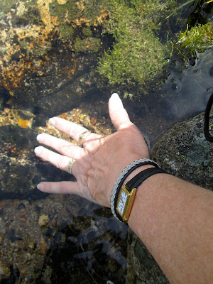
Cold Spring Campground is named for a natural spring that bubbles out of the rocks at the entrance.  It is well named; you can barely count to 10 while holding your hand in the ice-cold water before your fingers turn numb.  I felt I had to do it; I always wear Mother's favorite ring, which I believe she bought on her first or second trip to Colorado, and I felt like plunging my hand into the cold water was a way of making her a part of this trip.

The sign to Cold Spring Campground on Taylor Canyon Road 
The natural spring at the entrance.
It was all I could do to keep my hand in the water
long enough to snap this picture.  Brrrrr.
David and Karen at the spring. 
David poses by the campground sign.
The campground is positioned against a sharp rise, but across the Taylor Canyon Road you can make a gentle hike down to the Taylor River.  David has long lain claim to a  particular rock in the tumbling river that he likes to sit on and which normally can be reached with a stretch of the leg across the edge of the river.  But the recent rains had his rock under water, so he wasn't able to sit on it this time.

David standing where he normally would have been able to step across to
his rock.  The abundant rains this year have put the rock under the rushing water.
The Taylor River rushing toward Almont a few miles below, where it will
join with the Gunnison and East Rivers.
For most of the way from Almont, where we were camped, to a point just past the Cold Spring Campground, cattle are roaming free range on the government lands under grazing leases to private owners.  You will run into cattle ambling down the road, sometimes a small herd blocking both directions of traffic as they take their time deciding on which side of the road they want to be.  This mama cow and her calf were chugging their way down the side of the road.  We passed them on the way up the canyon and they passed us while we were visiting the campground.  I wonder every time we see the cattle roaming around how it is that they manage to survive with all the vehicles that are traveling up and down the road from Almont to Taylor Park and back.  But the speed limit is low and the sharp curves in the road keep the vehicles from going so fast that there is no time to react.


We spent an hour or so paying homage to memories tied up in the little campground and then moved on toward Taylor Park and another favorite scenic drive that has become a tradition.

Next up - Cumberland Pass.

LSW

Mountaineering, Part 2

A few hours with the breathtaking beauty of Lake Irwin left us ravenously hungry, so we decided it was time to tour the town of Crested Butte, with the first order finding a place to lunch.  Crested Butte has changed a little bit from the time I knew it so well, not so much in appearance as in content.  It used to be a sleepy little town with jewelry and art stores, tourist trap stores and a few restaurants.  Now it is less about the shopping and more about the eating and drinking.  The day we visited, it was buzzing with activity.  We were getting closer to the July 4th holiday and the tourist crowd was noticeably thickening.

For a tiny little town, there is an inordinate proportion of places to sample wines and beers and a wide variety of places to eat.  Alas, my favorite bakery where we used to acquire yummy sandwiches is long since gone, but we found a lovely little place with an outside patio where we could eat and people watch.

After lunch, we roamed around town and did a bit of shopping.  I found another choice miniature (the minis I brought back will probably get their own post when I wrap things up) and had a nice conversation with a gentleman who owned a better than average T-shirt and other apparel shop.  I had another lovely encounter with a lady in an art store where we ended up talking about a Beethoven print she had acquired in Paris.  It was a lovely couple of hours spent in a town that once was a favorite spot of mine.
Crested Butte, looking toward its namesake mountain

Crested Butte Main Street
It was a picture perfect day.
Although I hate to admit it, we found a Bluebonnet cousin that made our jaws drop.  It's really unfair that such a huge representation of the lupine family is found growing in Colorado and not in Texas.  They were abundant in the yards in this area, in all colors from white to pink to maroon to a very close approximation to our own Bluebonnet.  David placed his hand in the picture to prove to the folks back home just how big the things were.

Texas-sized lupines in Colorado
After we had reacquainted ourselves thoroughly with the charms of Crested Butte, we headed out into the back country on our second favorite scenic drive out toward the small historic town of Gothic.  Gothic would be a ghost town now if it had not been taken over by the Rocky Mountain Biological Laboratory and turned into a research center.  It really isn't a town any longer, but a restricted government area that you can drive through but not explore to any extent due to the biological studies that are in progress.

But if you keep on driving through, you begin climbing up into an area that is full of government campgrounds and some of the prettiest, most photogenic mountain scenery you could ask for.  The road gets a bit rough in places, but it is well worth the bumpy ride.
These are the mountains between Crested Butte and Aspen.

This is looking back at Crested Butte Mountain from the same point
as the previous photo.  You are surrounded by beautiful mountains on
every side.

David soaking up some clean mountain air.

Me, trying to blend into the lush green valley.

This was the point where we turned around to head back.  Just to the left
of this picture is a campground where David & Karen have tent-camped.
They were off exploring and reminiscing, while I was just drinking in
the mountains and enjoying a bit of meditative alone time, well
except for the non-stop traffic that was coming in from farther out.
It was difficult to get this photo with the clouds of dust being kicked
up by 4-wheel drive vehicles flying down the road.
On the way back toward Crested Butte, we made a point to stop and take a photo of the meandering stream that runs through the valley.  It has grown up a lot in the twenty years since I last stood at this spot and it was harder to get a photo, but the recent rains had the little stream full and the winding path of it is still such a lovely view.

Just above Gothic
There was a period of several years after I stopped visiting Colorado when I had a recurring dream of driving into Crested Butte and on out into the mountain valley beyond.  This part of Colorado is the stuff that dreams are made of and I hope the folks who are lucky enough to live there fully appreciate what they have.

As a parting side story, there was a time long, long ago when I actually seriously thought about moving to the Gunnison area and a vivid dream of running a yarn store with living quarters above the shop.  I subscribed to the Crested Butte paper for awhile and actually applied for a job.  I can't remember now what the job entailed, but I'm sure it was some kind of office position.  I knew it was an extreme long-shot that I would ever hear back from them, but in fact they did call and we had an interview over the telephone.  It turned out that the salary was barely enough to scrape by and not really a good enough reason to pull up roots and move, even with the pull of the mountains as added incentive.  So, being the pragmatist I am, I gave up the dream and settled for building that yarn store/apartment above in dollhouse form.  Every now and then I think wistfully of what might-have-been and go rearrange the dollhouse a little.

I was floored to find an actual source for yarn in Crested Butte, because I had looked for yarn stores in the areas where we were going to be and nothing had turned up on the Internet searches.  I'm fairly sure the lady running the shop doesn't depend on yarn sales for her living, but it was nice to be able to bring home some authentic locally dyed yarn as a souvenir of this trip.  It was just a wee bit like living out the dream, if only for a brief moment.

LSW