After leaving Cold Spring Campground, we kept climbing up the canyon toward Taylor Park. Taylor Park is a fishing hub that sits at a crossroads with a gorgeous lake and mountain view. Just before we reached the little settlement, we stopped for photos at our usual spot, a scenic overlook of Taylor Lake.
 |
| Picture perfect day |
 |
| David and Karen |
At the crossroads you can turn left and take the road to Cottonwood Pass, which ends up in Buena Vista and a good highway that runs back to Salida, about 50 miles from Gunnison. We always turn right and head for our number one favorite mountain road that goes to Tin Cup then climbs its way over Cumberland Pass and then heads down to Pitkin and Ohio City before coming out on the highway about 15 miles from Gunnison.
Tin Cup is a small historic settlement a few miles from Taylor Park. There's plenty of beautiful scenic drives that take off toward lakes and historic sites in various directions, but we usually settle for just looking at the town as we pass through. This time we ventured into a bit of new territory. For some reason we had never paid any attention to the sign that pointed off toward the Tin Cup Cemetery, but it caught our interest and since the genealogist in me hates to take any trip where I don't visit an old cemetery along the way, we veered off our course to check it out.
One thing that has changed tremendously since my last visit to Colorado is the proliferation of ATVs running around the backroads. We had expected to be the only visitors to the little rural burial ground, but it was a hopping tourist stop for the ATV crowd. The little parking lot was filled to capacity and people were wandering around all over the place. Thankfully all of them were showing proper respect and real interest in reading the old tombstones.
 |
| Every sign we saw on the way out had the same misspelling of "cemetary". |
 |
There were all kinds of grave borders, from iron fencing to log rails, and
all manner of tombstones, from modern granite to rough wooden planks. |
I would love to have had time to completely photo document the tombstones, but it wasn't feasible. The cemetery sprawled over a wide area, some parts of it separated by water and embankments that took a bit of effort to climb.
It wasn't far past Tin Cup that the road began a steep climb and we were on our way to Cumberland Pass. Slowly. The road gets a bit rough in places and there was still snow alongside the uppermost switchbacks. Along the way up we spotted a little vacation home that we might actually be able to afford. (But I wouldn't bet on it - property prices are as steep as their location in this part of the world.)
 |
Air-conditioned, one room cabin, spectacular scenery,
running water, solar heating, ecowise construction. |
The weather was getting a little dicey by the time we reached the summit, with distant lightning and thunder getting less distant by the minute. We stopped for some pictures, but decided that we should probably start down the mountain before any rain came along to make the drive any more difficult.
 |
Standing at the summit.
|
 |
| View from the top |
There is a cluster of old mine and cabin ruins that we always visit on the way down the mountain and by the time we reached that level, the threatening weather was beginning to get a bit closer and a lot louder, so we didn't hang around too long. But this is the first old mine ruin I ever got to get close to, so it is mandatory to visit on every trip. There is a bubbling creek that runs out of the ruins and on my first visit it was full of little tiny gold flecks that I decided just had to be gold dust. (Probably not, but it was my little fantasy and I scooped up a cup full of that sand flecked with gold and it's still with me somewhere in one of the closets.) The structures have decayed a noticeable bit since I last visited, but there is still a picturesque quality to the area and the next time I'm in Colorado, I'll be back for another look.
 |
| The old mine. |
 |
One of the old buildings at the foot of the mine.
|
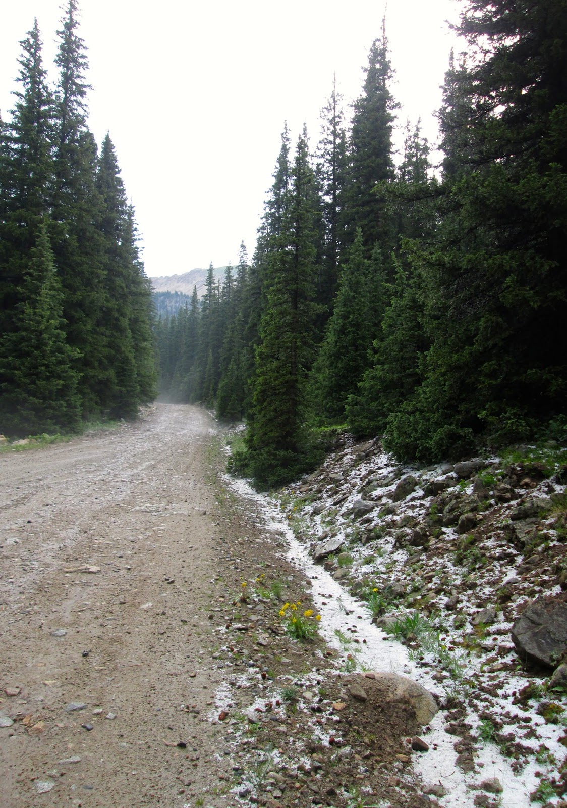
A little further down the mountain we finally ran into the weather and discovered fresh sleet all along the sides of the road.
 |
| Christmas trees and snow in July. |
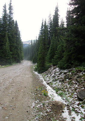 |
| The road back up the mountain. |
It was only a short drive on to Pitkin, where we stopped for coffee and snacks in a little cafe with a hyper-cheerful waitress, then it was back on the road to Gunnison.
The remainder of the afternoon was spent reacquainting ourselves with the shopping in Gunnison and driving through the campus of Western State College. Gunnison remains one of my favorite Colorado towns because it is a real town with real people. There is a thriving fishing business that Gunnison caters to, but mostly it is just a county seat with a small college and real people going about their real lives and not all that interested in sight-seeing tourists. (They're happy to see you and your money, don't get me wrong, but there really isn't that much "tourist" fare to be found in the shops. For that you need to keep driving up to Crested Butte.)
Our last night in Gunnison was marked by a nice meal at the Old Miner's restaurant and another spell of sitting out on the deck above the Taylor River. I was edgy about the next day and all the different connections I would have to make to get on the plane to go home, but I was feeling very satisfied with having reconnected with all the many well-remembered, well-loved spots I knew from so many years ago.
Next up - heading home
LSW


No comments:
Post a Comment